Property Record
5667 Redan Rd, Stone Mountain, GA 30088


Property Detail
5667 Redan Rd
16-062-05-033
94 X 250 X 24 X 24 X
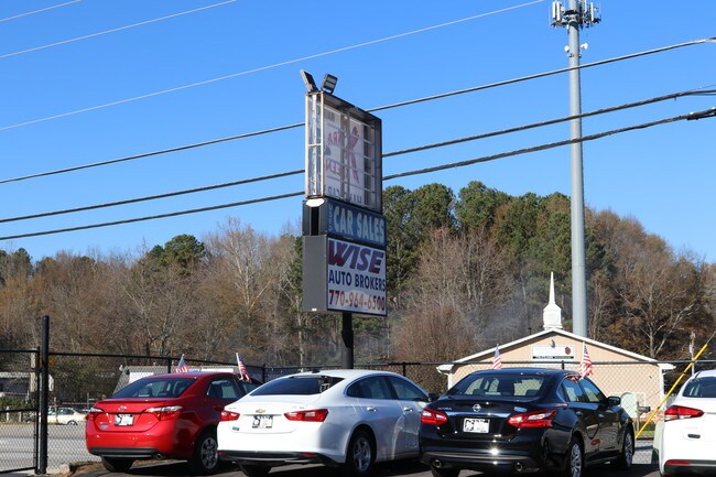
Carwash
DeKalb
X
Georgia
B and X Area of moderate flood hazard, usually the area between the limits of the 100-year and 500-year floods.
33
2025
0.72 AC
2025
Stone Mountain
023332
Atlanta
2,400 SF
Atlanta-Sandy Springs-Roswell, GA
NEARBY LISTINGS FOR SALE OR LEASE
DEMOGRAPHICS near 5667 Redan Rd
1 mile
3 mile
5 mile
2025 Total Population
8,268
82,389
214,666
2030 Population
8,321
83,178
217,351
Pop Growth 2025-2030
+ 0.64%
+ 0.96%
+ 1.25%
Average Age
41
39
39
2025 Total Households
2,847
28,979
78,609
HH Growth 2025-2030
+ 0.56%
+ 0.83%
+ 1.21%
Median Household Inc
$75,659
$66,767
$62,058
Avg Household Size
2.80
2.80
2.60
2025 Avg HH Vehicles
2.00
2.00
2.00
Median Home Value
$255,518
$259,257
$266,024
Median Year Built
1981
1985
1984
Nearby Places
Map Layers
Map Styles
 Street
 Aerial
Layers
 Traffic
 Biking
Places
Listings with unknown addresses are not visible on the map
- Restaurants
- Banks
- Shops
- Fitness
- Groceries
PUBLIC TRANSPORTATION
AIRPORT
Hartsfield - Jackson Atlanta International
Drive
Walk
Distance
Hartsfield - Jackson Atlanta International
34 min
20.7 mi
SALE & LEASE HISTORY
LISTING DATE
SALE/LEASE

Jul 10, 2018
For Sale
Dec 12, 2017
For Sale
Nearby Properties
Address
Land Use
TOTAL SIZE
Lot Size
Zoning
Address
Land Use
TOTAL SIZE
Lot Size
Zoning
988,394 SF
102.84 AC
RM100
Address
Land Use
TOTAL SIZE
Lot Size
Zoning
614,505 SF
97.30 AC
Address
Land Use
TOTAL SIZE
Lot Size
Zoning
271,666 SF
33.72 AC
RM100
Address
Land Use
TOTAL SIZE
Lot Size
Zoning
81,537 SF
9.27 AC
C1
Address
Land Use
TOTAL SIZE
Lot Size
Zoning
292,395 SF
19.65 AC
RM100
Address
Land Use
TOTAL SIZE
Lot Size
Zoning
814,943 SF
40.83 AC
M
Address
Land Use
TOTAL SIZE
Lot Size
Zoning
249,668 SF
16.76 AC
RM100
Address
Land Use
TOTAL SIZE
Lot Size
Zoning
34,138 SF
10.97 AC
MR1
Address
Land Use
TOTAL SIZE
Lot Size
Zoning
175,082 SF
14.87 AC
X
Address
Land Use
TOTAL SIZE
Lot Size
Zoning
210,070 SF
14.81 AC
RM100
Address
Land Use
TOTAL SIZE
Lot Size
Zoning
372,399 SF
12.63 AC
M
Address
Land Use
TOTAL SIZE
Lot Size
Zoning
174,655 SF
14.12 AC
X
Address
Land Use
TOTAL SIZE
Lot Size
Zoning
83,910 SF
10.90 AC
RCH
Address
Land Use
TOTAL SIZE
Lot Size
Zoning
72,755 SF
5.17 AC
C1
Address
Land Use
TOTAL SIZE
Lot Size
Zoning
137,574 SF
10.40 AC
RM100
Address
Land Use
TOTAL SIZE
Lot Size
Zoning
96,556 SF
11.67 AC
X
Address
Land Use
TOTAL SIZE
Lot Size
Zoning
128,149 SF
10.86 AC
RM100
Address
Land Use
TOTAL SIZE
Lot Size
Zoning
116,473 SF
15.63 AC
C-1
Address
Land Use
TOTAL SIZE
Lot Size
Zoning
33,448 SF
2.07 AC
C-1
Address
Land Use
TOTAL SIZE
Lot Size
Zoning
258,641 SF
17.77 AC
M: INDUSTR
Address
Land Use
TOTAL SIZE
Lot Size
Zoning
253,861 SF
19.28 AC
X
Address
Land Use
TOTAL SIZE
Lot Size
Zoning
123,401 SF
9.27 AC
RCD
Address
Land Use
TOTAL SIZE
Lot Size
Zoning
128,508 SF
11.62 AC
RCD
Address
Land Use
TOTAL SIZE
Lot Size
Zoning
55,604 SF
4.85 AC
C-3
Address
Land Use
TOTAL SIZE
Lot Size
Zoning
13,232 SF
205.25 AC
X
Address
Land Use
TOTAL SIZE
Lot Size
Zoning
51,654 SF
4.63 AC
RCH
Address
Land Use
TOTAL SIZE
Lot Size
Zoning
154,005 SF
7.40 AC
X
Address
Land Use
TOTAL SIZE
Lot Size
Zoning
78,600 SF
4.99 AC
M
Address
Land Use
TOTAL SIZE
Lot Size
Zoning
150,000 SF
13.24 AC
M
Address
Land Use
TOTAL SIZE
Lot Size
Zoning
93.79 AC
RM100
The World's #1 Commercial Real Estate Marketplace
Connect with us
© 2026 CoStar Group
The information above has been obtained from sources believed reliable. While we do not doubt its accuracy we have not verified it and make no guarantee, warranty or representation about it. It is your responsibility to independently confirm its accuracy and completeness. Any projections, opinions, assumptions, or estimates used are for example only and do not represent the current or future performance of the property. The value of this transaction to you depends on tax and other factors which should be evaluated by your tax, financial, and legal advisors. You and your advisors should conduct a careful, independent investigation of the property to determine to your satisfaction the suitability of the property for your needs.